What is Glacier terminus?
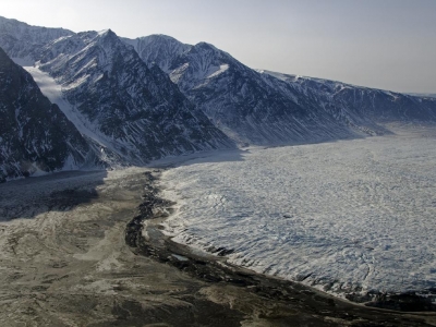
The glacier terminus is the lower end of a glacier. it is sometimes called the toe or snout. Some glaciers end further down a mountain, where the ice melts to form lakes and streams. Others reach the coast, where large chunks break off into the sea, creating icebergs. This is called calving.
Tracking the change in location of a glacier terminus is a method of monitoring a glacier's movement. The end of the glacier terminus is measured from a fixed position in neighboring bedrock periodically over time. The difference in location of a glacier terminus as measured from this fixed position at different time intervals provides a record of the glacier's change. A similar way of tracking glacier change is comparing photographs of the glacier's position at different times.
The form of a glacier terminus is determined by many factors. If the glacier is retreating, it is usually mildly sloping in form because a melting glacier tends to assume this shape. But there are many conditions that alter this typical shape, including the presence of thermal fields and various stresses that cause cracking and melting feedback resulting in glacial calving and other diverse forms.
Picture Credit : Google
Comments
No comments