Kenya: Where history, nature, and culture meet

Often known as the cradle of humanity, Kenya has fossilised remains of hominids, is home to over 40 ethnic groups, and has the highest concentration of wild animals in the world.

Ranu Joardar

 Kenya, one of the countries in East Africa, has often been described as "the cradle of humanity”. It is an important business, financial, and transportation hub as about 80% of East Africa's trade flows through its Mombasa Port.

History

Kenya's history dates back to millions of years as some of the earliest fassilised remains of hominids have been discovered here. For instance, findings by anthropologist Richard Leakey in the Koobi Fora area along the shore of Lake Rudolf have included portions of ‘Australopithecus boisei’ and ‘Homo habilis’ (extinct species of human) skeletons.

 An important part of Kenyan history is slavery. During the 1600s and 1700s, most Kenyans were taken as slaves by the Arabs, Europeans, and Americans.

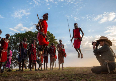
For several centuries, people from across regions have also settled in or travelled to Kenya. The Maasai tribe came to what is now known as central Kenya from north of Lake Rudolf (now called Lake Turkana in the Kenyan Rift Valley) in around mid 18th Century.

Geography

Kenya is surrounded by South Sudan, Ethiopia, Somalia, Indian Ocean, Tanzania, Lake Victoria, and Uganda.

The 38th meridian, the longitude that extends from the North Pole to the South Pole, divides Kenya into two halves. Kenya's terrain rises from the low coastal plain on the Indian Ocean towards the mountains and plateaus.

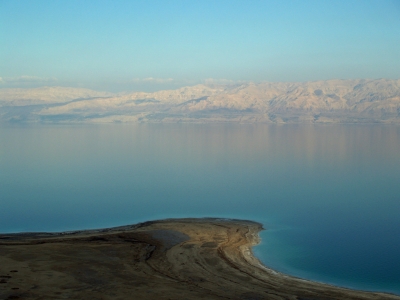
The country's capital, Nairobi, is at an altitude of 5,500 feet. From the west of Nairobi, the terrain descends to the Great Rift Valley, which has jade-green waters of famous Lake Turkana.

Kenya was the first African country to tap geothermal energy (heat energy from the Earth). The Hell's Gate National Park's geysers and hot springs are used to harvest geothermal energy and fuel almost half of Kenya's electricity.

Flora and fauna

Kenya's highlands consist of patches of evergreen forest separated by wide expanses of short grass. The forests have economically valuable trees such as cedar and varieties of podo.

Kenya's ecosystem includes deserts, swamps, and even glaciers on Mount Kenya, Africa's second highest peak. Each region has different plants and animals suited to the area's particular conditions. The semi-desert regions below 3,000 feet have baobab trees.

The Masai Mara, situated in south-west Kenya, is one of Africa's greatest wildlife reserves. It is named after the Maasai tribe, the ancestral inhabitants of the area. It has the highest concentration of wild animals in the world and over 40% of Africa's larger mammals can be found here. During the migration, over 1.5 million wildebeest migrate from southern Serengeti (in Tanzania) to the Masai Mara. They travel 800 km clockwise in a circle through the Serengeti and Masai Mara ecosystems to search for greener mineral-rich pastures and water. The annual migration at the end of the rainy season (usually in May or June) is recognised as one of the "Seven Wonders of the Natural World".

The country's wildlife population is mostly found outside the country's numerous national parks and game reserves. For instance, baboons and zebras are found along the Nairobi-Nakuru highway, near human settlements and urban centres.

The rainforests in highlands have various large mammals such as elephants and rhinoceroses. Besides, bushbuck, colobus monkeys, and galagos are also found in the region. The highlands have predators such as lions, leopards, and wildcats.

People

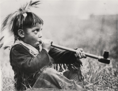
The land is home over 40 ethnic groups such as Kikuyu, Luhya, Kalenjin, Maasai, Luo, and Kamba. The country is divided into three language groups- Bantu, Nilo-Saharan, and Afro-Asiatic.

In the 19th Century, several Indians and Pakistanis came to the region, thus influencing the country's language - Swahili. Swahili evolved along the coast from elements of local Bantu languages-Arabic, Persian, Portuguese, Hindi, and English. It is the lingua franca, a language used as a means of communication, between populations speaking vernaculars that are not mutually intelligible. It is also the language of local trade and is used along with English as an official language in the Kenyan legislative body, the National Assembly, and the courts.

Most Kenyans live in the highlands. Most of the population is rural and live in scattered settlements. Before European colonisation, the urban areas constituted only the fishing regions, Arab trading ports, and towns that were visited by dhows (sailing boats) from the Arabian Peninsula and Asia. People began migrating from the rural to the urban areas after the country's independence in 1963.

Music and storytelling are important parts of the Kenyan culture. For centuries, the tribes used songs, stories, and poems to pass on their beliefs, history, and customs. Though school is free of cost, most children have to help their families by working the land, tending cattle, cooking, or fetching water.

Government

The country was a colony of the United Kingdom from 1920 till its independence on December 12, 1963 (known as the Jamhuri Day). The first President Jomo Kenyatta was an icon of the liberation struggle, who led Kenya from 1963 until his death in 1978, when Vice-President Daniel arap Moi took power in a constitutional succession.

According to the first constitution after independence, the Prime Minister was appointed as the head of a cabinet chosen by a bicameral National Assembly. Over the years, several constitutional reforms were made, and in 2010 a new constitution was promulgated. The country is now a republic, with a President, a national assembly, called the Bunge, and a legal system.

Picture Credit : Google 

What are the historical walls around the world?

Walls are often erected as military fortifications. Be it the long, winding 'Great Wall of China' or the Peace Walls which are being pulled down, walls are cloaked in mystery and have many tales to narrate. Here is a peek at some of the unique walls in the world.

BERLIN WALL - GERMANY

 In 1949, Germany split into two- the East Germany which allied itself to the Soviet Union and West Germany. A large number of people started moving from Soviet-controlled East Germany to the West. In response to this, the country's government decided to construct a wall. It was built as a barrier surrounding West Berlin thereby preventing any access to West Germany. At first, the wall was built using barbed wire and later followed by concrete. When the Soviet Union began to collapse, the wall was opened and was demolished later.

WALLS OF TROY - TURKEY

Troy is the lost city that has captivated people for years. And so has the Trojan war. This legendary war that was fought between the people of Troy and the Greeks forms the premise of Homer's Illiad. Even as the occurrence of the Trojan war remains a debate, the city of Troy in Turkey is of archeological interest. The ruins of the famous walls at this ancient site are still standing, whispering legends from the past.

GREAT WALL OF CHINA - CHINA

 Running more than 20,000 km, the Great Wall of China is the most famous border wall in the world. Its construction started in the 7th century BCE and went on for two millennia. The wall was built across northern China and southern Mongolia. Many workers died during its construction. Although the gigantic wall was built, it could’t withstand the invasions. For instance, Genghis khan and his Mongolian army could easily break in.

BELFAST PEACE WALLS - NORTHERN IRELAND

In Belfast, a unique 'ritual' has been going on for the past few years. Here, the walls are being pulled down. Back in 1969, Peace Walls (Peace Lines) were constructed in Belfast to separate Catholic neighbourhoods from Protestants. Northern Ireland was going through a conflict period Troubles, with unionists wanting to be a part of the United Kingdom and nationalists (Catholics) wanting to stay with Ireland. Around 100 walls were eventually erected. In 2013, the Northern Ireland government decided to dismantle the walls to improve community relations and have set 2023 as the target for this. Many walls have been dismantled till now.

GREAT WALL OF GORGAN –IRAN

Built in the 5th- 6th century, the great wall of Gorgan was constructed as a barrier in northern iran. The wall was erected to ward off attacks from the Turks and it comprises around 40 forts.

HADRIAN’S WALL – U.K.

Built in the years of 122-30 CE, by the order of the Roman Emperor Hadrian, the hadrian’s wall ran a length of 72 miles. The Roman frontier was built to protect northwestern Britain from barbarians. The walls give an idea of Roman Empire’s military architecture and also had towers and barracks.

Picture Credit : Google 

Can you measure time with sand?

The hour glass was a good way of measuring time. It was in use for hundreds of years. Fine sand trickles through a small hole in the glass from the top half to the bottom. When the top is empty the glass is turned over. Tournaments were timed by the turn of a glass.

Little written evidence exists to explain why its external form is the shape that it is. The glass bulbs used, however, have changed in style and design over time. While the main designs have always been ampoule in shape, the bulbs were not always connected. The first hourglasses were two separate bulbs with a cord wrapped at their union that was then coated in wax to hold the piece together and let sand flow in between. It was not until 1760 that both bulbs were blown together to keep moisture out of the bulbs and regulate the pressure within the bulb that varied the flow.

While some early hourglasses actually did use silica sand as the granular material to measure time, many did not use sand at all. The material used in most bulbs was "powdered marble, tin/lead oxides, [or] pulverized, burnt eggshell". Over time, different textures of granule matter were tested to see which gave the most constant flow within the bulbs. It was later discovered that for the perfect flow to be achieved the ratio of granule bead to the width of the bulb neck needed to be 1/12 or more but not greater than 1/2 the neck of the bulb.

Picture Credit : Google

Can you stay warm in an igloo?

You can. The Eskimo igloo is a temporary home used on hunting trips. It is built by cutting large blocks of hard packed snow and placing them one on top of another to form a dome shaped house. Fur rugs are spread on the floor. Light and warmth come from a small lamp that burns seal oil.

An igloo floor is never just flat like the inside of a tent. It's cut into terraces which create an upper level for sleeping, a middle level for the fire and a lower level used as a cold sink. Heavy cold air, which naturally falls, collects on the floor – ideally near the door - and stays there. And warm air, which is lighter and naturally rises, stays in the parts of the igloo people use the most, including the area they sleep in.

Because the door of an igloo is at the bottom of the structure and features at least one right angled piece of tunnel to crawl through, the powerful, freezing cold Lapland winds can't blow directly into the living space. And the little hole cut into the top of the curved roof lets smoke from the fire escape safely.

All this means it can be as cold as minus fifty degrees Fahrenheit outdoors but as cosy as 19 to 61 degrees Fahrenheit indoors, not always warm enough for a T shirt but a temperature difference that'll feel really good all the same, sometimes as much as seventy degrees warmer than the outdoors.

Credit : Transun 

Picture Credit : Google

Did the Indians always have horses?

Horses did not exist in America until the Spaniards brought them in the 16th century. It was over 100 years before the Indians had them. At first the Indians were terrified of the horse, but later they became the best horsemen in the world.

When the first horses arrived they looked like very wonderful and magical dogs that could carry a lot of stuff. That is why many Plains Indians called horses "sacred dogs".

In a very short time Plains Indians learned to be expert riders. Along with hunting they learned to use the horses to make war and go on raids. They could go much farther than they ever could on foot and arrive rested and able to fight. The tribes who learned how to use horses first and fast had a huge advantage over other tribes. They quickly pushed other tribes out of their former territories and expanded their territories. Tribes like the Comanche and Cheyenne who had horses and knew how to use them first pushed other tribes like the Apache, Wichita and Tonkawa south and west off the plains. The Apache who now live in New Mexico and in Old Mexico used to live way up in the Texas panhandle and north of Texas. Bands of Comanche warriors on horseback were powerful and feared by everyone – Indians and Europeans.

Picture Credit : Google

Is the croissant French?

In 1683 Vienna was under siege from the Turks. Men baking bread during the night heard the Turkish army tunnelling under the city. They raised the alarm, saved the city and baked croissants in the shape of the crescent Moon on the Turkish flag!

The story dates to 1683, during the Ottoman Turks siege of Vienna. Legend has it that a baker working late at night heard the Turks tunneling under the walls of the city and alerted the military.

The military collapsed the tunnel in on the Turks and eliminated the threat, saving the city. The baker baked a crescent shaped pastry in the shape of the Turk’s Islamic emblem, the crescent moon, so that when his fellow Austrians bit into the croissant, they would be symbolically devouring the Turks.

Marie Antoinette popularized the croissant in France by requesting the royal bakers replicate her favorite treat from her homeland, Austria.

Then, August Zang, an Austrian artillery officer that founded a Viennese Bakery in Paris in around 1839. This bakery served Viennese specialties including the kipfel (croissant) and the Vienna loaf and quickly became very popular and inspired French bakers. The dough became lighter and more delicate throughout time, and the kipfel was developed into what it is known now as the croissant.

Today, the croissant is both a symbol of French culture and tradition, shared throughout the world. Share this story the next time you enjoy one of our delicious croissants.

Picture Credit : Google

Where do you find gargoyles?

Stonemasons in the Middle Ages carved animal heads, devils and grotesque faces as water spouts. They took rainwater from church or cathedral roofs and kept the water clear of the stone walls.

Gargoyles are carved stone creatures known as grotesques. Often made of granite, they serve an important purpose in architecture. Other than providing interesting decoration for buildings, they contain spouts that direct water away from the sides of buildings.

Like modern gutter systems you might see on houses or newer buildings, gargoyles prevent rainwater from running down stone walls, eroding the mortar that holds a building together. Architects often designed buildings with multiple gargoyles to direct the flow of rainwater.

Many gargoyles feature troughs cut into their backs to catch water. The water that's caught is usually directed out of the open mouth of the creature. Gargoyles usually have an odd, elongated shape, because their length determines how far from the building's walls the rainwater is deposited.

The word gargoyle comes from the French word gargouille, which means “throat" or “gullet." This probably comes from the gurgling sound of the water as it passes through the gargoyle and out its mouth. Some legends hold that gargoyles also protect against harmful spirits.

Gargoyles have been used for hundreds of years. Ancient Egyptians usually created gargoyles in the shape of a lion's head. Other popular animal gargoyles were dogs, wolves, eagles, snakes, goats, and monkeys.

Over the years, many other types of creatures have been used as gargoyles. For example, some gargoyles are humans, such as monks, while others are combinations of humans and animals. Unusual animal combinations are sometimes called chimeras. Some popular chimeras include griffins, centaurs, harpies, and mermaids.

Some of the most famous gargoyles in the word sit atop cathedrals, such as Notre Dame in Paris. Some experts believe they were popular on churches because of the widespread belief that they protected against evil spirits.

After the eighteenth century, gargoyles became much less common, as more modern drainpipes were developed. Occasionally, some buildings would still be built with gargoyles, but they often became more decorative than functional.

Credit : Wonderopolis

Picture Credit : Google

What is the Dead Sea?

It is a lake 369m (1,299ft) below sea level on the Israel/Jordan border. The water is seven times more salty than sea water. No fish can live in this water and swimmers float, but cannot sink.

Situated on the heart of the Great Syrian-African rift valley that stretches throughout Israel and beyond, the Dead Sea is the lowest point on the earth, 1,320 feet below sea level and is flanked by the Judean Mountains on the west, the Hashemite Kingdom of Jordan and the Mountains of Moab on the east, the Jordan Valley and Sea of Galilee to the north and the Negev Desert as well as the Red Sea to the south.

The human history of the Dead Sea goes all the way back to remote antiquity. Just north of the Dead Sea is Jericho, the oldest continually occupied town in the world. The Greeks knew the Dead Sea as Lake Asphaltites, due to the naturally surfacing asphalt. Aristotle wrote about the remarkable waters. The Dead Sea is also the location of the Qumran community which produced the Dead Sea Scrolls. These ancient texts, preserved in sealed caves near the shore of the Dead Sea, provide remarkable insight on the religious and social beliefs of 1st-century Jews. King Herod the Great built and re-built several fortresses and palaces on the Western Bank of the Dead Sea. The most famous was Masada, where, in 66-70 AD, a small group of rebellious Jewish zealots held out against the might of the Roman Legion, and Machaerus where, it is believed John the Baptist had been imprisoned by Herod Antipas and met his death.

Credit : Sea Salt

Picture Credit : Google

Is the Red Sea red?

The Red Sea owes its name to an algae that gives a red tinge to the water. This narrow inland sea is a branch of the Indian Ocean between north east Africa and the Arabian peninsula.

The Red Sea contains some of the world’s hottest and saltiest seawater. With its connection to the Mediterranean Sea via the Suez Canal, it is one of the most heavily traveled waterways in the world, carrying maritime traffic between Europe and Asia. Its name is derived from the colour changes observed in its waters. Normally, the Red Sea is an intense blue-green; occasionally, however, it is populated by extensive blooms of the algae Trichodesmium erythraeum, which, upon dying off, turn the sea a reddish brown colour.

The Red Sea occupies part of a large rift valley in the continental crust of Africa and Arabia. This break in the crust is part of a complex rift system that includes the East African Rift System, which extends southward through Ethiopia, Kenya, and Tanzania for almost 2,200 miles and northward for more than 280 miles from the Gulf of Aqaba to form the great Wadi Aqaba–Dead Sea–Jordan Rift; the system also extends eastward for 600 miles from the southern end of the Red Sea to form the Gulf of Aden.

The Red Sea valley cuts through the Arabian-Nubian Massif, which was a continuous central mass of Precambrian igneous and metamorphic rocks (i.e., formed deep within the Earth under heat and pressure more than 540 million years ago), the outcrops of which form the rugged mountains of the adjoining region. The massif is surrounded by these Precambrian rocks overlain by Paleozoic marine sediments (542 to 251 million years old). These sediments were affected by the folding and faulting that began late in the Paleozoic; the laying down of deposits, however, continued to occur during this time and apparently continued into the Mesozoic Era (251 to 65.5 million years ago). The Mesozoic sediments appear to surround and overlap those of the Paleozoic and are in turn surrounded by early Cenozoic sediments (i.e., between 65.5 and 55.8 million years old). In many places large remnants of Mesozoic sediments are found overlying the Precambrian rocks, suggesting that a fairly continuous cover of deposits once existed above the older massif.

Credit :  Britannica 

Picture Credit : Google

What are truffles?

Truffles are an expensive food delicacy used in the very best French pates. They look like large spongy walnuts and grow in the ground. Because they like to eat them, pigs are often used to find truffles.

The most-valued truffle in French cuisine is the Perigord (Tuber melanosporum), which is said to have first gained favour toward the end of the 15th century. It is brown or black, rounded, and covered with polygonal wartlike protrusions, having a depression at their summit; the flesh (gleba) is first white, then brown or gray, and when mature becomes black with white veins having a brown margin. The odour is well marked and pleasant. The main French truffieres (truffle grounds) are in the south, notably in Perigord and the region of Provence–Alpes–Cote d’Azur, though truffles are gathered throughout a large part of France.

The truffle industry is an important one in France, and about one-third of the gatherings are exported. The French government undertook the reforesting of many large and barren areas, for many of the best truffle regions become productive by the planting of trees, particularly oaks. Because truffles often occur at depths down to about 30 centimetres (12 inches), it is difficult to detect them unaided. Truffles, when occurring near the surface of the ground, crack it as they reach full size, and experienced gatherers can detect them. Furthermore, in the morning and evening, columns of small yellow flies may be seen hovering over a colony. Occasionally an individual is sufficiently sensitive to the scent of truffles to locate them, but truffle hunting is usually carried on with the aid of trained dogs or female pigs (which are attracted by the truffle’s scent, similar to that of male pig pheromones).

Although truffles are much desired as food, direct cultivation of truffles for commerce is difficult. Calcareous ground is dug over and acorns or seedlings planted. Soil from truffle areas is usually spread about, and the ground is kept in condition by light plowing and harrowing. After three years, clearings are made and the trees pruned. If they are to appear, truffles do so only after about five years; gathering begins then but is not very profitable until 8 or 10 years have passed. The yield is at its maximum from 5 to 25 years later.

Credit : Britannica 

Picture Credit : Google

Which great musician was deaf?

Ludwig van Beethoven, born in Bonn in 1790, was one of the world's greatest. composers. He began to lose his hearing at the age of 26, and by 1823 he was completely deaf. Beethoven never heard his nine symphonies or piano concertos, or any of his other compositions during the last ten years of his life.

Like many men of the late 18th and early 19th centuries, he suffered from a plethora of other illnesses and ailments. In Beethoven’s case, the list included chronic abdominal pain and diarrhea that might have been due to an inflammatory bowel disorder, depression, alcohol abuse, respiratory problems, joint pain, eye inflammation, and cirrhosis of the liver. This last problem, given his prodigious drinking, may have been the final domino that toppled him into the grave. Bedridden for months, he died in 1827, most likely from liver and kidney failure, peritonitis, abdominal ascites, and encephalopathy. An autopsy revealed severe cirrhosis and dilatation of the auditory and other related nerves in the ear.

A young musician named Ferdinand Hiller snipped off a lock of hair from the great composer’s head as a keepsake — a common custom at the time. The lock stayed within the Hiller family for nearly a century before somehow making its way to the tiny fishing village of Gilleleje, in Nazi-controlled Denmark and into the hands of the local physician there, Kay Fremming. The doctor helped save the lives of hundreds of Jews escaping Denmark and the Nazis for Sweden, which was about 10 miles across the Øresund Strait, the narrow channel separating the two nations. The theory is that one of these Jewish refugees, perhaps a relative of Ferdinand Hiller, either gave Dr. Fremming the lock of Beethoven’s hair or used it as a payment of some kind.

At any rate, the doctor bequeathed the lock, consisting of 582 strands, to his daughter, who subsequently put it up for auction in 1994. It was purchased by an Arizona urologist named Alfredo Guevera for about $7,000. Guevera kept 160 strands. The remaining 422 strands were donated to the Ira F. Brilliant Center for Beethoven Studies at San Jose State University in California.

Guevera and Ira Brilliant, a real estate developer, collector and university benefactor, then pursued the question of how Beethoven became deaf.

Credit : PBS News Hour 

Picture Credit : Google

What is a sundial?

The sundial works just like the stick and the stones. People put them in their gardens or on buildings and tell the time by the moving shadow. The trouble was they didn't work in the dark!

The first device for indicating the time of day was probably the gnomon, dating from about 3500 BCE. It consisted of a vertical stick or pillar, and the length of the shadow it cast gave an indication of the time of day. By the 8th century BCE more-precise devices were in use. The earliest known sundial still preserved is an Egyptian shadow clock of green schist dating at least from this period. The shadow clock consists of a straight base with a raised crosspiece at one end. The base, on which is inscribed a scale of six time divisions, is placed in an east-west direction with the crosspiece at the east end in the morning and at the west end in the afternoon. The shadow of the crosspiece on this base indicates the time. Clocks of this kind were still in use in modern times in parts of Egypt.

Another early device was the hemispherical sundial, or hemicycle, attributed to the Greek astronomer Aristarchus of Samos about 280 BCE. Made of stone or wood, the instrument consisted of a cubical block into which a hemispherical opening was cut. To this block a pointer or style was fixed with one end at the centre of the hemispherical space. The path traveled by the tip of the pointer’s shadow during the day was, approximately, a circular arc. The length and position of the arc varied according to the seasons, so an appropriate number of arcs was inscribed on the internal surface of the hemisphere. Each arc was divided into 12 equal divisions, and each day, reckoned from sunrise to sunset, therefore had 12 equal intervals, or “hours.” Because the length of the day varied according to the season, these hours likewise varied in length from season to season and even from day to day and were consequently known as seasonal hours. Aristarchus’s sundial was widely used for many centuries and, according to the Arab astronomer al-Batt?n? (c. 858–929 CE), was still in use in Muslim countries during the 10th century. The Babylonian astronomer Berosus (flourished c. 290 BCE) invented a variant of this sundial by cutting away the part of the spherical surface south of the circular arc traced by the shadow tip on the longest day of the year.

Credit : Britannica 

Picture Credit : Google

What do 'port' and 'starboard' mean?

In the days before boats had a central rudder they were steered by an oar called a 'steer board' on the right hand side.

To avoid crushing the steer board, the boat tied up in port on the left hand side, hence the names 'port' and 'starboard'.

In the past, ships used to have rudders on their centre line and they were controlled using a steering oar. As it is the case today, back then as well the majority of the people were right handed.

Thus, as most of the sailors were right handed, the steering oar used to control the ship was located over or through the right side of the stern.

For this reason, most of the seafarers were calling the right side as the ‘steering side’, which later was known as ‘starboard’.

As the right side was the steerboard side or star board side, the left side was the port side. This was decide so that the dock would not interfere with operating the steerboard or star.

Another reason why the left side is ‘port’ is because it sounds different from ‘starboard’. Originally, sailors were calling the left side ‘larboard’, which was easily confused with ‘starboard’, especially when challenging conditions at sea made it difficult to hear. The switch was done to lead to a distinctive alternate name.

Namely, the old English name for the port side sounded like ‘backboard’. On big vessels, the sailor using the steering would have his back facing the ship’s left side.

As a result, ‘backboard’was named ‘laddebord’, which is the loading side of the ship. Later, ‘laddebord’ became ‘larboard’, causing the confusion that led to change to port.

This is why ships are using the terms ‘port’ and ‘starboard’, as they are unambiguous references that are independent of a mariner’s orientation.

With these terms, seafarers remove ambiguity, and they prefer them over using the terms left and right.

Credit : Intlreg 

Picture Credit : Google

What happened to St Lucia?

Christmas in Sweden begins on December 13, which is St Lucia's day. Long ago the early Christians were persecuted and had to meet in dark underground caves. St Lucia risked her life to bring them food. On her head she wore a crown of candles to light her way. One day she was caught by the Roman Emperor's soldiers and killed.

Today she is remembered each Christmas by young Swedish girls. They get up early on St Lucia's day dress as she did to take buns and coffee to their families - who are still in bed!

In actuality, Lucy was probably a victim of the wave of persecution of Christians that occurred late in the reign of the Roman emperor Diocletian. References to her are found in early Roman sacramentaries and, at Syracuse, in an inscription dating from 400 CE. As evidence of her early fame, two churches are known to have been dedicated to her in Britain before the 8th century, at a time when the land was largely pagan.

St. Lucy is venerated on her feast day, December 13, by a variety of ceremonies. In Sweden, St. Lucia’s Day marks the beginning of the Christmas celebration. On that day the eldest daughter of the family traditionally dresses in a white robe and wears as a crown an evergreen wreath studded with candles. The festival is meant to bring hope and light during the darkest time of the year.

Credit : Britannica 

Picture Credit : Google

What was a peace pipe?

The peace pipe was a sacred object to the Indians. Called a 'calumet' it was usually made out of stone. All important dealings were sealed with the smoking of the peace pipe. To break your word after this would make the spirits very angry.

The Sacred Pipe was revered as a holy object, and the sacrament of smoking was employed as a major means of communication between humans and sacred beings; the narcotic effect of tobacco and the symbolism of the indrawn and ascending smoke affirmed that such communication took place. The pipe itself was a symbolic microcosm. Its parts, its colours, and the motifs used in its decoration each corresponded to essential parts of the indigenous universe. The pipe was smoked in personal prayer and during collective rituals, and both of these uses commonly began with invocations to the six directions: east, south, west, north, skyward, and earthward. Among some tribes such as the Pawnee, Omaha, and Crow, complex pipe dances were developed that presented smoke offerings to the Almighty on behalf of the entire community

Credit :  Britannica 

Picture Credit : Google