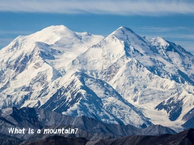
What are the different parts of a mountain?

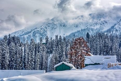
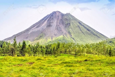
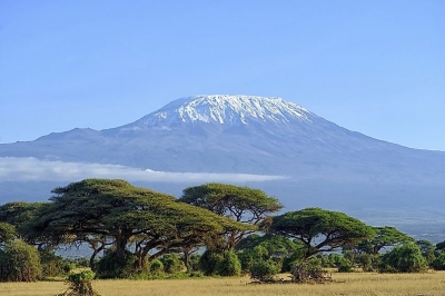
You may have observed that as we go up a mountain, the terrain changes. The lower slopes are milder and warmer with plenty of greenery. Higher up, we may start seeing evergreen trees like pine or deodar. If we travel even further up, there is a good chance we would see snow.

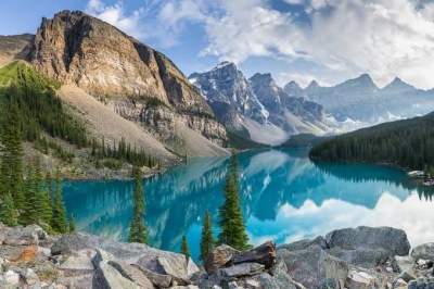
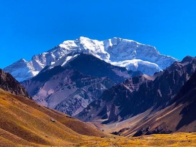
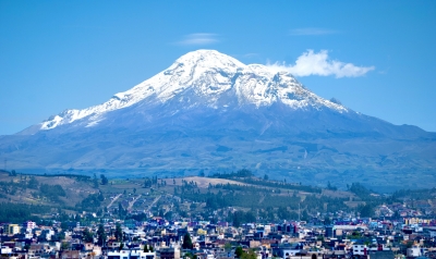
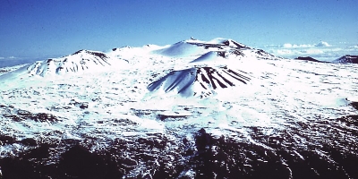
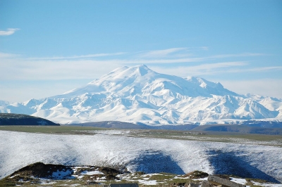
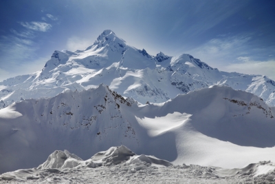
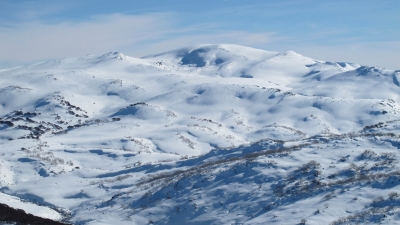
Based on this difference in terrain, a mountain may be divided into three regions, the lower slopes, the timber line and the snow line. The lower slopes are found at the base of a mountain. Here the slope is more gradual and the climate is warmer. The timber line is the upper limit of the tree-growing area of a mountain. Above this line trees will not grow. The height of the timberline varies from mountain to mountain. The timberline is lower in temperate climates and higher in tropical ones.

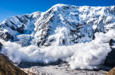
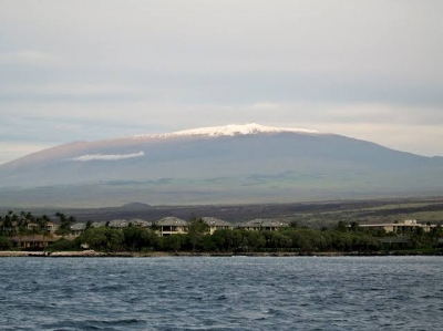
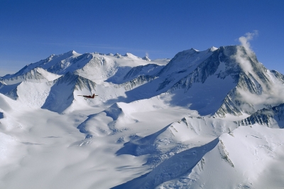
Nearer to the top of the mountain, we come to the snow line. Above this line the mountain is always covered in snow. The snowline in tropical countries is much higher than that in temperate countries or Polar Regions. In tropical countries it can be 20,000 feet over sea-level while in the Arctic region the snow line continues to the sea.

Picture Credit : Google

What do valley, glacier and avalanche mean?

A valley is low-lying land in between hills or mountains. It is usually narrow and slopes in a particular direction. Valleys can be shallow with gentle slopes or deep with steep slopes. They often have a river flowing through them. Such valleys are called river valleys.

A glacier is a large area of thick ice which slides slowly down a valley towards lower levels. It is formed when snow remains frozen for a long period of time and accumulates into a dense mass of ice. Glaciers are found on every continent of the world, except Australia. Glaciers change the shape of the land they pass through due to the abrasive action of the ice and sediments in them on the landscape. A glacier is sometimes called a moving river of ice.

An Avalanche is the rapid and sometimes deadly flow of ice down a slope of a hill or a mountain. It is caused when a large mass of snow accumulates on a mountain and topples down due to its enormous weight. It can be triggered by human activity, snowpack (hardened snow) and weather conditions. An avalanche becomes bigger as it moves further down. It accumulates trees, earth and rocks as it moves and can be fatal to anyone in its path.

Picture Credit : Google

Why do we love mountains?

The view from the top of a mountain is always awe-inspiring and many climbers risk life and limb just for a chance to experience this. At the same time the mountains themselves provide some of the most beautiful scenery in the world. Most people prefer to holiday in the mountains than in the plains. So why are mountains so fascinating?

Most mountains have steep sides and a conical shape that ends in a peak. The top of the mountain is called its summit and its sides are called its slopes. The summit may sometimes be covered in snow and hidden by clouds. The slopes may either be rocky and barren or covered in lush green forests or grass.

Sometimes the exposed rock of a mountain may have different colours due to metals and minerals present in it. The Vinicunca Mountain found in Peru is also called the “rainbow mountain”. Its considerable mineral deposits give it pink, yellow, red and green stripes. Visitors to this mountain describe it as a sight from another world!

In the chidren’s classic ‘Heidi’ by Johanna Spyri, the Swiss Alps are described as covered in alpine flowers and stately fir trees. Closer to home, the mountains of Munnar in South India are known for their lush green tea plantations and breath-taking views. With all this natural beauty, it’s no wonder that we love mountains.

Picture Credit : Google

How are mountains formed? How are they categorized?

Mountains are categorized by the way in which they are formed. The most common type of mountains are called fold mountains. They are created over millions of years. These mountains are formed when two tectonic plates collide head-on and their edges are thrown up, like a flat piece of paper rising up when pressure is applied to its ends. Examples of Fold Mountains are the Himalayas in Asia, the Alps in Europe and the Andes in South America.

Another category of mountains are called Block Mountains. These mountains form when faults or cracks in the Earth’s surface cause some rocks to rise up and others to go down. The uplifted parts are called ‘horsts’ and the lowered parts are called ‘graben’. The Rhine valley (graben) and the Vosges Mountain (horst) in Europe are examples of Block Mountains.

Dome Mountains are the result of molten magma pushing its way up from the mantle of the Earth into the crust. This magma or melted rock does not erupt onto the Earth’s surface but pushes up the overlying layers. The force or pressure of the magma produces a domelike shape on top.

Another category of mountains are volcanic mountains. These are formed when molten rock or magma deep within the earth, erupts, breaks through the Earth’s crust and piles up on the surface. Magma is called lava when it breaks through the Earth’s crust. Many layers of lava cool and solidify to form mountains. Mount St. Helens in North America and Mount Loa in Hawaii are examples of Volcanic Mountains.

Plateau Mountains, also called Erosion Mountains, are large flat areas that have been pushed above sea level by forces within the Earth. They are then worn down by wind and water into mesas and canyons. The Tibetan Plateau is the largest plateau in the world.

Picture Credit : Google

Why do we need to study mountains beneath the sea?

Mountains formed by volcanic activity under the seabed and submerged under the sea are called seamounts. The Earth’s oceans have more than 14,500 identified seamounts that cover an area of more than 85 lakh sq. kilometres.

If you are fooled into thinking that these mountains serve no purpose, you would be wrong. Scientists have discovered that seamounts are wildlife hotspots. Because of their abundance, they form one of the most important marine ecosystems in the world. Interactions between seamounts and underwater currents attract a variety of wildlife. The steep slopes of the seamounts carry nutrients upwards from the depths of the seafloor towards the surface, providing food for sea creatures.

Seamounts also provide support for corals and sponges to grow. Whales, dolphins and sharks rely on seamounts to feed and rest during migrations. They have an effect on ocean currents and tides as well.

The mid-Atlantic ridge, which forms the longest chain of undersea mountains, is made of abundant seamounts. Scientists are able to locate undersea mountains with the help of an echo sounder. This is a device that measures the depth of the seabed by calculating the time taken for the echo to return to the listener. Such studies provide important insights into what causes earthquakes and improves our preparedness in case of a disaster.

Picture Credit : Google

How much of the Earth is covered by mountains?

Around 26.5 per cent of the Earth’s land surface is covered by mountains. The continents of Europe and Asia are together called Eurasia. Together they take up around 36.2 per cent of the Earth’s surface. Around 33 percent of Eurasia is covered by mountains. North America comes next with 24 per cent of the land classified as mountainous. In South America, 19 per cent of land is mountainous and in Africa this figure is 14 per cent.

Asia has one of the tallest mountain ranges in the world, the Himalayas. The Himalayas are approximately 2,400 kilometres long and span China, Nepal, India, Pakistan, Afghanistan and Bhutan. The Andes Mountain range stretches about 7,242 kilometres along the western side of South America and is the longest in the world. This range is famous for its volcanoes. The Alps Mountain range passes through France, Germany, Switzerland, Italy and Austria. The Alps are known for its beautiful lakes.

One of the largest mountain ranges in North America is the Rocky Mountain range. It stretches 4,800 kilometres from Canada down to the state of New Mexico in the USA. The Appalachian Mountain range extends over 3,219 km and is one of the oldest mountain ranges in the world. They were formed nearly 480 million years ago. The Atlas Mountains are 1,497 km long and are found in North-western Africa. They are mineral-rich as well as home to a significant number of plant and animal species.

Picture Credit : Google

What is a mountain?

Mountains are usually big, tall and majestic. They are raised portions of the Earth’s crust. A mountain can also be defined as land that is raised higher than the surrounding area. However, not all raised landforms can be called mountains. Smaller landforms that rise are called hills. Mountains usually have steep sides and tower over the surrounding land. Sometimes you may even see clouds covering their peaks. Hills are usually much smaller than mountains.

One way to distinguish between a hill and a mountain is to compare their shapes. Mountains are usually cone-shaped with a peak, while hills are more rounded and do not have a distinct peak. Another way is to look at their heights. A landform that is lower than 300 m is categorized as a hill and higher than 300 m is considered a mountain. This may vary, though. Different countries have different criteria for classifying mountains. For instance in the USA, the Watchung Mountains are less than 200 m high, while in the Himalayas, a 400 m-high mountain is called a “foothill”.

Similarly Cavanal hill in Oklahoma, US is around 600 m and is considered the world’s highest hill and Mount Wyche-proof in Australia is the world’s smallest mountain at a height of148 m.

Picture Credit : Google

Where are mountains found?

Mountains are found on every continent and in every environment on Earth. Mountains are even found in space! The largest mountain in our solar system is Olympus Mons which is found on planet Mars.

Some mountains rise from the seabed and are completely submerged under the water. In some cases these mountains are visible only at the tip in the form of islands. Some of these underwater mountains are even taller than Mt. Everest. For Example Mauna Kea, which is found in Hawaii, is actually a high mountain rising from the seafloor of the Pacific plate. It is almost 500 m higher than Mt. Everest!

Most mountains are part of a mountain range. A mountain range consists of several mountains or hills connected in a line and by high ground. They are usually formed by the same geological process. Most mountain ranges are usually formed as a result of plate tectonics, that is, movements of the large slabs of solid rock in the Earth’s outer shell. Therefore, they are formed at the edges of continents.

A group of mountain ranges is called a mountain system or a cordillera. The tallest mountain range in the world is the Himalayas in Central Asia and the longest is the Andes in South America. Mountain ranges are also found under the sea, such as the mid-ocean ridge, which is nearly 65,000 km long.

Picture Credit : Google

Where is Chimborazo located?

Chimborazo is a currently inactive stratovolcano in the Cordillera Occidental range of the Andes. Chimborazo had been thought to be extinct, but new studies have shown that it still is an active volcano. Although there are no historical eruptions,
Chimborazo erupted at least 7 times during the past 10,000 years. These eruptions produced pyroclastic surges that reached down to 3800 m elevation. The average time interval between single eruptions is about 1000 years and the last eruption occurred about 1400 years ago, which means that statistically, it is due for another one.

The dominantly andesitic-to-dacitic Chimborazo volcano is mostly of Pliocene-to-Pleistocene age. The volcano collapsed about 35,000 years ago, producing a major debris avalanche, whose deposits underlie Riobamba and temporarily dammed the Río Chambo, producing an ephemeral lake.
Subsequent eruptions have been dominantly andesitic and constructed three edifices along an east-west line, the youngest and westernmost of which forms the current summit of Chimborazo.

Chimborazo's summit is the farthest point of the earth's surface from the center of the earth. Due to the centrifugal forces of its rotation, the earth's shape deviates from a perfect shpere and has a larger diameter at the equator than the length of its N-S axis. The distance of Chimborazo's summit from the center is 6,384.4 km, 2229 m more than the distance of Mt Everest's top to the center.

Picture Credit : Google

Where is Mauna Kea located?

Mauna Kea is a dormant volcano on the island of Hawai?i. Its peak is 4,207.3 m (13,803 ft) above sea level, making it the highest point in the state of Hawai?i and second-highest peak of an island on Earth. It is about a million years old, and has thus passed the most active shield stage of life hundreds of thousands of years ago.

With its high elevation, dry environment, and stable airflow, Mauna Kea's summit is one of the best sites in the world for astronomical observation. Since the creation of an access road in 1964, thirteen telescopes funded by eleven countries have been constructed at the summit. The Mauna Kea Observatories are used for scientific research across the electromagnetic spectrum and comprise the largest such facility in the world. Their construction on a landscape considered sacred by Native Hawaiians continues to be a topic of debate to this day.

The geologic landscape of Hawaii’s islands has changed greatly over time, which has also impacted its ecologic landscape. As Hawaii’s volcanic islands rise and fall, organisms must adapt to a series of transitional habitats both above and below the ocean surface. In terms of the habitats and species that are part of Mauna Kea—from its mountain peak to its ocean deep—the colossal mountain is not only tall, but high in biodiversity as well. Mauna Kea’s variety of terrestrial habitats includes stone deserts, shrublands, alpine woodlands, and tropical forests. These varied habitats are home to several endemic species that are only found on Hawaii or the Hawaiian archipelago. The ocean habitats that characterize Mauna Kea are equally varied and full of life. The greatest quantity of marine life is found between the surface and a depth of 1,189 meters (3,900 feet, 0.7 miles) in the sunlight zone and twilight realm. Below 3,900 feet are the midnight zone and abyss, which are dark, cold, under high pressures, and lacking in food. Species in these extreme environments have developed unique adaptations to regulate their temperatures, protect themselves, help them locate food, communicate, and find mates.

Picture Credit : Google

Where is Mount Elbrus located?

Mount Elbrus is the highest and most prominent peak in Russia and Europe. It is situated in the western part of the Caucasus; and is the highest peak of the Caucasus Mountains. 

As Elbrus is located in the Northern Hemisphere, the summer period, the least rigorous, takes place from June to mid-September with an average of 50% of sunny days favorable to the ascent of the summit. However, the winds, dominated by westerly air masses, can turn violent and temperatures drop very quickly. Above 4000 meters above sea level, even in summer, arctic blizzard conditions with near zero visibility can develop. It is not uncommon for the wind to exceed 100 km/h. In winter, the temperature can drop below ?50° at the top, but in the valleys hot, dry downdrafts can cause heavy snowfall. At low altitudes, the average precipitation is 500 mm and can reach 1000 mm in some years, while above 2000 meters it can exceed 1500 mm.

All mountains can be and on Elbrus the weather and altitude present the main issues as there are few objective dangers on the main climbing routes. The north side is more dangerous in terms of it being more remote and there is none of the infrastructures that you find on the south side. Statistically Elbrus represents a high number of fatalities when compared to the other Seven Summits, and the reason appears to be an underestimation of the challenge compared to the likes of Everest, Denali or Aconcagua. With such temperamental weather, ill-equipped and complacent groups (often without good guides) get caught out in low visibility, which has led to a lot of the accidents and in turn exposure, exhaustion and falls having come off the route.

Picture Credit : Google

Where is Mount Kilimanjaro located?

Located in Tanzania, Mount Kilimanjaro is Africa’s tallest mountain at about 5,895 meters (19,340 feet). It is the largest free-standing mountain rise in the world, meaning it is not part of a mountain range.

Kilimanjaro is the fourth most topographically prominent peak on Earth. It is part of Kilimanjaro National Park and is a major climbing destination. Because of its shrinking glaciers and ice fields, which are projected to disappear between 2030 and 2050, it has been the subject of many scientific studies.

Kilimanjaro is attested to in numerous stories by the peoples who live in the East Africa. The Chagga, who traditionally lived on the southern and eastern slopes of the mountain, tell how a man named Tone once provoked a god, Ruwa, to bring famine upon the land. The people became angry at Tone, forcing him to flee. Nobody wanted to protect him but a solitary dweller who had stones that turned miraculously into cattle. The dweller bid that Tone never open the stable of the cattle. When Tone did not heed the warning and the cattle escaped, Tone followed them, but the fleeing cattle threw up hills to run on, including Mawenzi and Kibo. Tone finally collapsed on Kibo, ending the pursuit.

Picture Credit : Google

Which is the tallest mountain in Europe?


Mount Elbrus is a dormant volcano and the highest mountain in Europe. Its summit is 18,510 feet (5,642 meters) above sea level. It is located in Russia.


With an elevation of 18,510 feet (5,642 meters), it is part of the Caucasus Range that straddles Asia and Europe, although most geographers place it in Europe. This makes it the tallest mountain in Europe and one of the Seven Summits, the highest mountains in each of the continents and elite climbers aspire to summit all of them.


Mount Elbrus’ prominence —a measure of how distinct a mountainis from nearby peaks — is 15,554 feet (4,741 m), making it the 10th most prominent mountain in the world. The east summit is slightly lower at 18,442 feet (5,621 m).


Elbrus has a unique cable car system, which was built on the south side of the mountain from 1959 to 1976. The cable car reaches 12,500 feet (3,658 m).  From there, most climbers take the Standard Route up the south side to the summit.


While the lack of crevasses can lull climbers into a false sense of safety, the Standard Route is challenging due to the snow, high winds and a high elevation. About 15 to 30 climbers die each year, which is a fairly high ratio of climbers to climber deaths when compared to other mountains.


Picture Credit : Google


Which is the tallest mountain in Australia?


Mount Kosciuszko is the tallest mountain peak in mainland Australia at 2,228 meters (7,310 feet) tall. It is located in the state of New South Wales, in the southeastern part of the country. It is not technically Australia’s largest peak, because a volcano (Mawson Peak) on the Australian-owned Heard Island off the coast of Antarctica is taller. While Mawson Peak is politically part of Australia, geographically it is considered to be “sub-Antarctica.”


The mountain is sometimes included as part of the Seven Summits mountaineering challenge, in which mountain climbers summit the tallest mountain on every continent. There is some controversy over whether Mount Kosciuszko or Indonesia’s Puncak Jaya should be the seventh mountain. This debate comes from the geographical definition of the continent of Australia/Oceania. Mount Kosciuszko is the highest mountain on Australia, however, when taking into account all of Oceania, Puncak Jaya in Indonesia is technically the higher mountain. Many climbers climb both mountains to cover all bases.


Picture Credit : Google


Which is the tallest mountain in Antarctica?


Vinson Massif is a large mountain massif in Antarctica that is 21 km (13 mi) long and 13 km (8 mi) wide and lies within the Sentinel Range of the Ellsworth Mountains. It overlooks the Ronne Ice Shelf near the base of the Antarctic Peninsula. 


Climbed for the first time in 1966, Vinson still sees very few visitors and remains a pristine and majestic peak. To reach this remote area of the world, we fly from Punta Arenas, Chile and land on the blue ice runway of Union Glacier. A short flight then brings us to Vinson Base Camp at the foot of the Branscomb Glacier in the Ellsworth Mountains. From here we ascend the Branscomb Glacier and climb the headwall on Vinson, setting up two camps along the way. Summit Day is one of the most spectacular of any big climb in the world: as we ascend from our High Camp (12,400') the views of the immense ice sheets which surround the Massif gradually come into view, the final steep push up the summit ridge is exhilarating but not technically difficult, and standing atop this remote summit a climber looks for miles in all directions onto a landscape virtually untouched by humans.


Most climbers ascend up the Branscomb Glacier, known as the Normal Route, and make it in about 10 days. About 1,000 climbers have summited Mt. Vinson, much fewer than the other Seven Summits. While other summits are more challenging from a technical climbing perspective, the cold, windy conditions and the short window of opportunity to climb keep many climbers from making it to the top. There is also the cost involved, which can be $30,000 or more because of the summit's remoteness.


Picture Credit : Google