In which state is Vythiri is located?
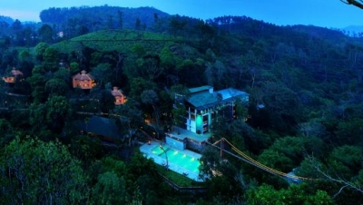


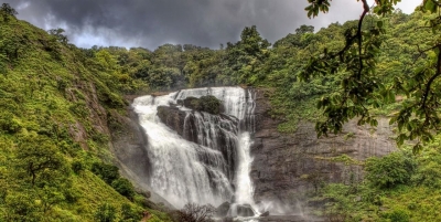
Vythiri is a small town and tourist destination located in the Wayanad district in the Indian state of Kerala. It is one of the three Taluks in the district with the other two being Mananthavady and Sulthan Bathery.


According to the local legend, an English engineer built the Ghat road to Vythiri on the basis of the information given by a tribal youth. After getting the necessary guidance, the English people killed the tribal guide. The spirit of the tribal youth got angry and caused many accidents in the road. So a priest took the initiative to chain the spirit to a tree in Vythiri. This Chain Tree is seen even today at Lakkidi. Some of the passing motorists even pay homage to the tree for allowing a safe passage.


Lakkidi is a small village near Vythiri. It is situated on the entrance to Wayanad district. There is a hotel management college oriental school of hotel management and a veterinary university in Lakkidi.


Vythiri is 66 km by road from Kozhikode railway station and this road includes nine hairpin bends. The nearest major airport is at Calicut. The road to the east connects to Mysore and Bangalore. Night journey is not allowed on this sector as it goes through Bandipur national forest.


Picture Credit : Google

What is the official name of Ooty?


The name probably changed under British rule from Udagamandalam to Ootacamund, and later was shortened to Ooty.


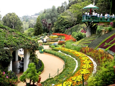
Ooty officially known as Udagamandalam, is a town and a municipality in the Nilgiris district of the Indian state of Tamil Nadu. It is located 86 km north of Coimbatore and 128 km south of Mysore and is the headquarters of the Nilgiris district. It is a popular hill station located in the Nilgiri Hills. Local residents call it Queen of Hills.


Originally occupied by the Toda people, the area came under the rule of the East India Company at the end of the 18th century. The economy is based on tourism and agriculture, along with the manufacture of medicines and photographic film. The town is connected by the Nilgiri ghat roads and Nilgiri Mountain Railway. Its natural environment attracts tourists and it is a popular summer destination. In 2011, the town had a population of 88,430.


Ooty is situated in the Nilgiri Biosphere Reserve. Many of the forested areas and water bodies are off-limits to most visitors in order to protect this fragile ecosystem. Some areas of the Biosphere Reserve have been earmarked for tourism development, and steps are being undertaken to open these areas to visitors whilst conserving the area. It is situated at an altitude of 2,240 metres (7,350 feet) above sea level.


Picture Credit : Google


Called Mecara during the British Raj, which hill town is the headquarters of the Kodagu district?


Madikeri (also known by its former name Mercara) is a hill station town in Madikeri taluk in Kodagu district, India. It is the headquarters of the district of Kodagu.


Madikeri was known as Muddu Raja Keri, which meant Mudduraja's town, was named after the prominent Haleri king Mudduraja who ruled Kodagu from 1633 to 1687. From 1834, during the British Raj, it was called Mercara. It was later renamed to Madikeri by the Government of Mysore.


The history of Madikeri is related to the history of Kodagu. From the 2nd to the 6th century AD, the northern part of Kodagu was ruled by Kadambas. The southern part of Kodagu was ruled by Gangas from the 4th to the 11th century. After defeating the Gangas in the 11th century, Cholas became the rulers of Kodagu. In the 12th century, the Cholas lost Kodagu to the Hoysalas. Kodagu fell to the Vijayanagar kings in the 14th century. After their fall, the local chieftains like Karnambahu (Palegars) started ruling their areas directly. 


As of 2011 India census, Madikeri had a population of 33,381. Males constitute 57.2% of the population and females 42.8%. Madikeri had an average literacy rate of 85%, higher than the national average of 57.2: male literacy was 83%, and female literacy 80%. 11% of the population was under 6 years of age. This town is situated at an elevation of over 3770 ft above sea level.


Picture Credit : Google


Situated on the Eastern Ghats in Visakhapatnam district, this picturesque valley showcases verdant fields?


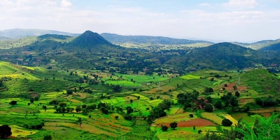
At an elevation of about 3200 ft, Araku is famous for its coffee plantations surrounded by beautiful gardens, streams, waterfalls and valleys that are covered with lush green forests. Situated in the Eastern Ghats, the hill station is about 112 km southeast of Vishakhapatnam.


Araku Valley can be reached by road that goes through thick forests which is an adventure in itself. There are many places of interest like the government silk farm, famous for its mulberry gardens and the tribal museum. The region is home to many tribes and the area is rich in tribal culture.


Being a mountainous region, trekking is a popular activity and the area offers several interesting trails. Most known and popular trekking trails go through dense forests to the summit but a few adventurous trails go through the many streams that dot the landscape and are ideal to view breathtaking waterfalls like the Sangda waterfall.


There are many budget hotels, cottages and resorts. State run lodges provide affordable accommodation and are clustered near the Araku railway station.


Mid-range options are mostly found near the road connecting Araku to Visakhapatnam and a few near Araku railway station.


Picture Credit : Google


Located less than 100 km from Mumbai, which hill station sitting on the Western Ghats is said to be automobile-free?


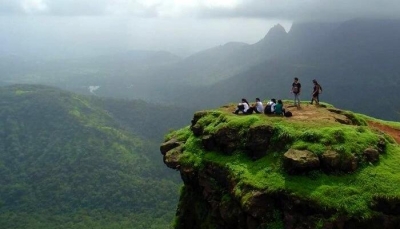
Tucked away in the Western Ghats at Raigad district in Maharashtra, this hill station can be accessed only on legs. Matheran, meaning ‘forest on the forehead’ is an eco-sensitive region lying about 100 km from Mumbai and 120 km from Pune.


There are around 38 designated look-out "points" (viewpoints) in Matheran, including the Panorama Point that provides a 360-degree view of the surrounding area and also the Neral town. Louisa Point has views of Prabal Fort. Other viewpoints include One Tree Hill Point, Heart Point, Monkey Point, Porcupine Point, and Rambagh Point. There are many hotels and Parsi bungalows in the area. Old British-style architecture is preserved in Matheran. The roads are not metalled and are made of red laterite earth.


The town also has a large monkey population, including bonnet macaques and Hanuman langurs. Domesticated horses for riding are also in large numbers and are one of the symbols of Matheran. Inside the forest animals like barking deer, Malabar giant squirrel, fox, wild boar, mongoose may be found. But these animals are rare in numbers compared to monkeys and usually do not venture where humans are present. So most likely one does not come across them. There have been reports of leopard sightings in Matheran few times in last decade. Leopards are not known to dwell in Matheran. But due to dense forests in valleys surrounding Matheran leopards who are on the roam may climb Matheran. Nowadays leopard sightings by locals are extremely rare due to dwindling leopard population in general all over the country. There has been no known incidence of leopard attacks in Matheran.


Picture Credit : Google


Which village on Meghalaya’s East Khasi Hills was once declared the cleanest village in Asia by a travel magazine?


Mawlynnong is a village in the East Khasi Hills district of the Meghalaya state in North East India. It is notable for its cleanliness.


Mawlynnong is known for its cleanliness. The waste is collected in the dustbins made of bamboo, directed to a pit and then used as manure. A community initiative mandates that all residents should participate in cleaning up the village. Smoking and use of polythene is banned while rainwater harvesting is encouraged.


The travel magazine Discover India declared the village as the cleanest in Asia in 2003, and the cleanest in India in 2005. This reputation has boosted local tourism; in 2017 NPR reported that, according to the village headsman, incomes had increased by 60 percent due to increased tourism.


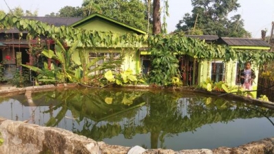
The concrete road cutting through the village will take you past small wooden houses with colourful gardens, unravelling why Mawlynnong is known as the cleanest village not only in India, but also in Asia. The village is made up of around 80 households, a majority of which are on a mission to keep the village spotlessly clean. There are bamboo baskets tied to trees outside every house to prevent people from littering. All this waste is collected in a pit, and later used as manure. Residents take turns to clean the roads, which are lined with creepers and flowering plants. Littering is a punishable offence and plastic has been completely banned in the village.


Picture Credit : Google


With Mt. Kanchenjunga in the background, which hill station in West Bengal is noted for its tea?


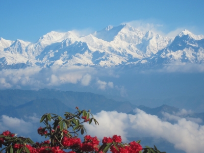
Darjeeling, Nepali is a city and a municipality in the Indian state of West Bengal. It is located in the Lesser Himalayas at an elevation of 2,000 metres (6,700 ft). It is noted for its tea industry, its views of Kangchenjunga, the world's third-highest mountain, and the Darjeeling Himalayan Railway, a UNESCO World Heritage Site.


This spectacular hill station of West Bengal is situated in an area which is called as Mahabharata Range and is widely known for its popular tea industry. With mesmerizing sunrises, untouched charm of hills, welcoming locales and old-world charm of the past makes Darjeeling one of the surreal hill stations in West Bengal. This hill station’s iconic attraction is the quintessential steam train which catches the attention of every tourist and is one of a kind experience. 


Darjeeling is a part of the Eastern Himalayan zoo-geographic zone. Flora around Darjeeling comprises sal, oak, semi evergreen, temperate and alpine forests. Dense evergreen forests of sal and oak lie around the town, where a wide variety of rare orchids are found. The Lloyd's Botanical Garden preserves common and rare species of plants, while the Padmaja Naidu Himalayan Zoological Park specialises in conserving and breeding endangered Himalayan species. The town of Darjeeling and surrounding region face deforestation due to increasing demand for wood fuel and timber, as well as air pollution from increasing vehicular traffic.


Picture Credit : Google


In which State is Nainital located?


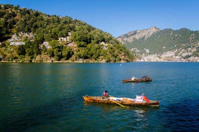
Nainital is a popular hill station in the Indian state of Uttarakhand. Nainital is the judicial capital of Uttarakhand, the High Court of the state being located there, and is the headquarters of the Kumaon division as well as an eponymous district. It also houses the Governor of Uttarakhand, who resides in the Raj Bhavan. Nainital was the summer capital of the United Provinces.


According to one, Nainital has derived its name from the Goddess Naina while the other legend says that when the Goddess Sati lost her eyes, she was being carried by Lord Shiva and a lake was formed. (‘Naina’ means eyes and ‘Tal’ means lake.) This beautiful small town in surrounded by seven hills, popularly known as ‘Sapta-Shring’ – Ayarpata, Deopata, Handi-Bandi, Naina, Alma, Lariya-Kanta and Sher-Ka-Danda. The majestic mountains and the sparkling waters of the lake add an immense lot to the beauty of the town.


Nainital has an advantage of being situated in vicinity of several other lesser known hill stations that are connected through all season motorable roads.Vantage points around Nainital offer a panoramic view of Himalayan peaks on one side and the plains spread out on the other. Narrow wooded lanes through forests of oak, pine and deodar are excellent for short refreshing walks. The older parts of Nainital also retain colonial vestiges, including sprawling bungalows, public schools, churches and the old Christian cemetery.


Picture Credit : Google


On the bank of which river is Manali located?


The Beas river which is also known as Vipasha in Sanskrit, is one of the most important and holy rivers that flows through the states of Himachal Pradesh and Punjab. Carrying with it years of history, legends and folklore, it is one of the longest rivers in the northern provinces of India flowing for a total of 470km in its entire course and length.  


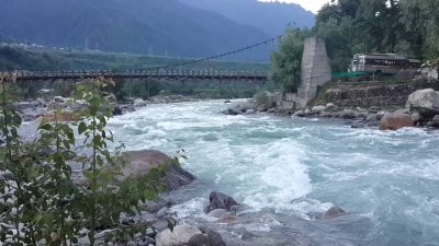
At Manali, the river passes through dense, evergreen forests of pine, deodar and birch as well snowy mountains of the lower Himalayas. It is a water body that flows all year round and provides drinking and usable water to residents of Kullu and Manali.


The attraction of the river has been so great that whoever came here, remained to stay. The great sages Narad, Vashisht, Vishwamitra, Vyas, Prashar, Kanav and Parshuram came here on different occasions and meditated on the banks of this river. Till today their temples exist in this valley of Vyas.


The Beas ( vedic Arjiki or Arjikiya and Sanskrit Vipasa ) forms the world famous valleys of Kullu and Kangra. This river bears testimony of those historical events which do not find mention in the recorded history. It has played a significant role in the development of peculiar hill culture which pervades the life of hill people living in the towns and surrounding villages since ages. We have to owe to this sacred river in terms of our culture, economy and social life. The important settlement on the bank of Beas river are Kullu, Mandi, Bajaura, Pandoh, Sujanpur Tihra, Nadaun and Dehra-Gopipur. The total length of this river is 460 km.


Picture Credit : Google


In which Union Territory Pahalgam is located?


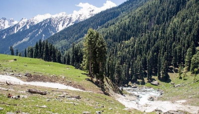
Pahalgam is a town and a notified area committee in Anantnag district of the Indian union territory of Jammu and Kashmir. It is a popular tourist destination and hill station. Its lush green meadows and pristine waters attract thousands of tourists from all over the world each year.  It is located 45 kilometres (28 mi) from Anantnag on the banks of Lidder River at an altitude of 7,200 feet (2,200 m). 


Pahalgam is administered by the Pahalgam Development Authority, headed by a Chief Executive Officer who functions as the administrator of local town area committee.


The origin of Pahalgam is obscure. Mughal rulers ruled this region in the medieval period. It was later a part of the Kingdom of Kashmir, which was ruled by local Hindu rulers. This princely state remained independent even during the British period and later on merged into independent India.


Pahalgam is the starting point of the annual Amarnath yatra (holy journey) to the holy cave shrine of Amarnath, which is said to be the abode of Lord Shiva. Every year in the month of July/August, thousands of pilgrims descend on Pahalgam on their way to the holy cave.


Picture Credit : Google