On which river bank did the Battle of the Hydaspes happen?


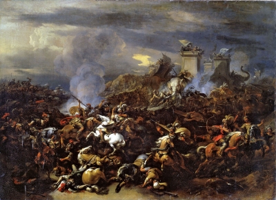
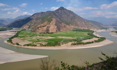
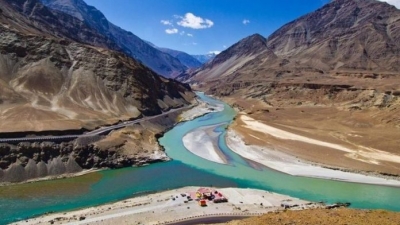
Battle of the Hydaspes, (326 BCE), fourth and last pitched battle fought by Alexander the Great during his campaign of conquest in Asia. The fight on the banks of the Hydaspes River in India was the closest Alexander the Great came to defeat. 


The battle took place on the east bank of the Hydaspes River (now called the Jhelum River, a tributary of the Indus River) in what is now the Punjab Province of Pakistan. Alexander later founded the city of Nicaea on the site; this city has yet to be discovered. Any attempt to find the ancient battle site is complicated by considerable changes to the landscape over time. For the moment, the most plausible location is just south of the city of Jhelum, where the ancient main road crossed the river and where a Buddhist source mentions a city that may be Nicaea. The identification of the battle site near modern Jalalpur/Haranpur is certainly erroneous, as the river (in ancient times) meandered far from these cities.


Alexander had to subdue King Porus in order to keep marching east.[citation needed] To leave such a strong opponent at his flanks would have endangered any further exploits. Alexander could not afford to show any weakness if he wanted to keep the loyalty of the already subdued Indian princes. Porus had to defend his kingdom and chose the perfect spot to check Alexander's advance. Although he lost the battle, he became the most successful recorded opponent of Alexander.


Picture Credit : Google


In which country does River Kwai flow?


The River Kwai, more correctly ‘Khwae Noi’ or Khwae Sai Yok is a river in western Thailand, near, but not over the border with Myanmar. It begins at the confluence of Ranti, Songkalia and Bikhli Rivers. 


The river is chiefly known from the Pierre Boulle novel and David Lean film The Bridge on the River Kwai, in which Australian, Dutch and British prisoners of war were forced by the Japanese to construct two parallel bridges spanning the river as part of the Burma Railway, also called the Death Railway, for the many lives lost in its construction. One bridge was wooden and temporary. The other was made of concrete and steel and still exists. The bridges actually spanned the Mae Klong, but as the railway subsequently follows the Khwae Noi Valley, the bridges became famous under the wrong name. In the 1960s, the upper part of the Mae Klong was renamed the Khwae Yai (big tributary”).


River Kwai Noi also runs through a national park, Saiyok National Park. The park’s area is approximately 500 square kilometers. Its landscape and scenery are arguably the most beautiful places in Thailand where once the famous Death Railway passed though Sai Yok Noi. The park’s major attractions are its waterfalls, including Sai Yok Yai waterfall which flows into the Khwae Noi river (River Kwai Noi).


Picture Credit : Google


Why is the Yellow River often referred to as "China's Sorrow"?


The Yellow River is also called "China's Sorrow". Each year, over 1.6 billion tons of soil flows into the Yellow River, which causes the continual rise and shift of the riverbed. Before damming, it was extremely prone to flooding, and had caused millions of deaths, including the deadliest disaster in human history.


With global warming, decrease in rainfall in the Yellow River Basin, and increasing water demands for irrigation, industry, etc., the Yellow River has been used up by its lower reaches since 1972, when it ran dry for the first time in recorded history. The longest dry period lasted 226 days in 1997.


Drought in the Yellow River region has brought serious challenges to agricultural development and the cities near the Yellow River.


What's worse, the river has been abused. It has become so polluted in some reaches that it is unfit for agricultural and industrial use, because of the huge increase in factory and sewage discharges from China's fast-expanding cities.


The government is taking measures to deal with Yellow River pollution, such as setting limits on the volume of major pollutants discharged into rivers and lakes, and controlling overuse of water resources.


Picture Credit : Google


The 1908 flooding of which river divides Hyderabad into the historic old city and the new city?


As Kerala grapples with a deluge of unimaginable proportions, the second time in under 100 years, it is interesting to remember the Hyderabad experience. Around 110 years ago on September 26, 1908, it began to rain in the surrounding areas of Hyderabad as a result of a cyclone in the Bay of Bengal. Over the next 48 hours, the downpour continued in the Musi river basin logging 98.57 cm rainfall. Of the 788 tanks and lakes in the river basin, 221 breached due to the cloudburst. 


According to historian Benjamin Cohen, the flood and deaths were used by the Nizam and his advisers to remake the city in a way that made it flood-proof. It also changed the power equations of the city.


Picture Credit : Google


From which river the Dead Sea receives almost all its water?


The northern half of the western shore lies within the Palestinian West Bank and has been under Israeli occupation since the 1967 Arab-Israeli war. The Jordan River, from which the Dead Sea receives nearly all its water, flows from the north into the lake.


The Dead Sea has the lowest elevation and is the lowest body of water on the surface of Earth. The Dead Sea lies in a desert. Rainfall is scanty and irregular. Al-Lis?n averages about 2.5 inches (65 mm) of rain a year, the industrial site of Sedom (near historical Sodom) only about 2 inches (50 mm). 


The waters of the Dead Sea are extremely saline, and, generally, the concentration of salt increases toward the lake’s bottom. That phenomenon can create two different masses of water in the lake for extended periods of time. Such a situation existed for some three centuries, lasting until the late 1970s.


Picture Credit : Google


In which country Yangtze River found?


Yangtze River, Chinese (Pinyin) Chang Jiang or (Wade-Giles Romanization) Ch’ang Chiang, longest river in both China and Asia and third longest river in the world, with a length of 3,915 miles (6,300 kilometres). Its basin, extending for some 2,000 miles (3,200 km) from west to east and for more than 600 miles (1,000 km) from north to south, drains an area of 698,265 square miles (1,808,500 square km). The Yangtze has eight principal tributaries. On its left bank, from source to mouth, these are the Yalung, Min, Jialing, and Han rivers; those on the right bank include the Wu, Yuan, Xiang, and Gan rivers.


The name Yangtze—derived from the name of the ancient fiefdom of Yang—has been applied to the river mainly by those in the West. Chang Jiang (“Long River”) is the name used in China, although it also is called Da Jiang (“Great River”) or, simply, Jiang (“[The] River”). The Yangtze is the most important river of China. It is the country’s principal waterway, and its basin is China’s great granary and contains nearly one-third of the national population.


Picture Credit : Google


Which is the longest river in Europe?


The longest river in Europe is the Volga, in Russia. It is 3,645 kilometres long and is the 15th longest river in the world. It is also Europe's largest river in terms of discharge, with 8,060 cubic metres per second.


Its source is in the Valdai Hills, 228 metres above sea level, and it flows through ten Russian oblasts (Tver, Yaroslavl, Kostroma, Ivanovo, Nizhny Novgorod, Ulyanovsk, Samara, Saratov, Volgograd and Astrakhan) and three republics (Mari El, Chuvashia and Tatarstan).


It flows into the Caspian Sea, and almost its entire course is navigable. The Volga's main tributaries are the Kama and the Oka rivers, and it has a total of about 200 tributaries.


Picture Credit : Google


How many rivers flow in Saudi Arabia?


Saudi Arabia does not have any permanent rivers, but does have numerous wadis (valley) which are riverbeds that are either permanently or intermittently dry.


This list is arranged by drainage basin, with respective tributaries indented under each larger stream's name.


Saudi Arabia has the largest economy in the Middle East, and as of 2018, it was the 18th largest economy globally. Saudi Arabia has no permanent rivers within its border. It is one of the 17 countries in the world without rivers.


Saudi Arabia had deep water holes around the 'Al-Kharj and lakes at the Layla Aflaj up until the 1980s. They were fed by massive underground aquifers that were formed several millions of years ago. The 'Al-Kharj was a critical source of drinking water. However, there are Wadis that serve as the source of water. The Wadis refer to a valley or a dry river bed which contain water, especially during the rainy season. Saudi Arabia stores approximately 6 billion cubic feet of water in the more than 200 dams found in the Wadi Bisha, Wadi Jizan, Wadi Fatima, and Najran among others.


Picture Credit : Google


From which river our country get its name?


The name 'India' is derived from the River Indus, the valleys around which were the home of the early settlers. The Aryan worshipers referred to the river Indus as the Sindhu. The Persian invaders converted it into Hindu. The name 'Hindustan' combines Sindhu and Hindu and thus refers to the land of the Hindus.


When the first Constitution of India came into existence on 26th January, 1950 Bharat was thought to be the other official name of the Republic of India.


Derived from the Sanskrit term 'Bharata' that means 'the cherished', this name dates back to the ancient 'Hindu Puranas' (Hindu scriptures) that tells the story of the legendary Emperor Bharata, the first conqueror of the entire Indian subcontinent and the Republic of India.  


Bharata is believed to be the founder of the famous Bharata dynasty. Therefore, after his conquer of the Indian land where he and his descendants dwelt, it started to be known as 'Bharatavarsa,' where varsa meant 'land' or 'continent'.


Picture Credit : Google


According to legend, which sage is associated with the creation of the river Cauvery?


River Cauvery representing the most important of the five elements — ?pas (water) — is drawing close to its holy Pushkaram season. We prepare for the rituals with prayerful anxiety for a return to the days of plentiful flow that had been our everyday experience half a century earlier. 


From Kodagu (Coorg) in Karnataka to Puhar (Kaveri-p-poompattinam) in Tamil Nadu, the Cauvery flows along 765 km. There is the prologue to the epic Manimekalai, which refers to the Cauvery coming to the Chola region. King Kantaman’s penance to quench the thirst of his land that was struck by drought moved Sage Agastya, who poured out water from his kamandala to flow forth as a river.


Legend might be a shadow of the past. Not so history. From its rise in the Sahyadri Hills, the Cauvery keeps rushing through the creation of great kingdoms, royal rivalries, innumerable battles and a readiness to give up one’s life to make a statement for the coming generations. 


Picture Credit : Google


Which river's name is the Sanskrit, Hindi and Tamil word for "big river"?


The word Mahanadi is a compound of the Sanskrit words maha ("great") and nadi ("river").


In different era, this river was known by several names, such as:


Ancient era – Kanaknandini


Dwapar yug – Chitrotpala ( Similar name in matasya Purana)


Treta yug – Nilotpala ( Similar name in vayu Purana)


Mahabharata era – Mahananda


Kal yug – Mahanadi or Mahashweta


The Mahanadi is an important river in the state of Odisha. This river flows slowly for about 900 kilometres (560 mi) and deposits more silt than any other river in the Indian subcontinent.


The cities of Cuttack and Sambalpur were prominent trading places in the ancient world and the river itself has been referred to as the Manada in Ptolemy's works. 


Picture Credit : Google


On the banks of which river is the statue of unity?


The statue depicts Sardar Vallabhbhai Patel, India's first Home Minister, wearing a traditional dhoti and shawl, towering over river Narmada.


The statue was inaugurated by Prime Minister Modi on 31 October, 2018. For many it was a source of national pride and a clear demonstration of Indian construction skills. But it wasn’t without its detractors. The sheer cost of the thing was and is an obvious bone of contention, with some arguing that Sardar Vallabhbhai Patel himself would never have approved of such a costly project.


Visitors can tour the memorial garden, exhibition center and museum located at the site, before venturing up to the statue’s observation deck at a height of 502 feet (153 m).


Visiting hours are from 9 a.m. to 5 p.m. from Tuesday to Sunday (the statue is closed every Monday for maintenance). Standard adult tickets, which include the observation deck, museum and memorial gardens, cost Rs 350.


Picture Credit : Google


Which is world's largest e-commerce company that named after the largest river in South America?


 Named after the South American river, Amazon sold its first book in July 1995. Jeff Bezos , by name of Jeffrey Preston Bezos, (born January 12, 1964, Albuquerque, New Mexico, U.S.), American entrepreneur who played a key role in the growth of e-commerce as the founder and chief executive officer of Amazon.com, Inc., an online merchant of books and later of a wide variety of products. Under his guidance, Amazon became the largest retailer on the World Wide Web and the model for Internet sales.


Amazon quickly became the leader in e-commerce. Open 24 hours a day, the site was user-friendly, encouraging browsers to post their own reviews of books and offering discounts, personalized recommendations, and searches for out-of-print books. In June 1998 it began selling CDs, and later that year it added videos. In 1999 Bezos added auctions to the site and invested in other virtual stores. The success of Amazon encouraged other retailers, including major book chains, to establish online stores.


Picture Credit : Google


Considered a holy river, the Ganges originates in the Himalayas. Which bay does it drain into?


The Ganges (Ganga) River is a sacred body of water to Hindus that begins high in the Himalaya Mountains and empties out into the Bay of Bengal. The surrounding river basin has a population of more than four hundred million people.


The Ganges flows south and east from the Himalayas, forming a canyon as it leaves the mountain. It winds its way through northern India, eventually emptying into the Bay of Bengal. The Ganges’ many tributaries originate from the nearby countries of Nepal, Bangladesh, and China (in an autonomous region called Tibet). 


The river is also used for fishing, irrigation, and bathing, and it is worshiped in the Hindu religion as the Mother Ganga. As the river empties into the Bay of Bengal, the mouth forms the Ganges River Delta, the largest river delta in the world.


Picture Credit : Google


Which river is called Jamuna in Bangladesh and Yarlung Tsangpo in Tibet?


The Brahmaputra is one of the major rivers of Asia, a trans-boundary river which flows through China, India and Bangladesh. It is known as the Yarlung Tsangpo River in Tibet, the Brahmaputra, Lohit, Siang, and Dihang in India, and the Jamuna in Bangladesh.


About 3,969 km (2,466 mi) long, the Brahmaputra is an important river for irrigation and transportation in the region. The average depth of the river is 38 m (124 ft) and maximum depth is 120 m (380 ft). The river is prone to catastrophic flooding in the Spring when the Himalayan snow melts. The average discharge of the river is about 19,800 m3/s (700,000 cu ft/s), and floods can reach over 100,000 m3/s (3,500,000 cu ft/s). It is a classic example of a braided river and is highly susceptible to channel migration and avulsion. It is also one of the few rivers in the world that exhibits a tidal bore. It is navigable for most of its length.


Picture Credit : Google