Scientists have wanted that a weather phenomenon called the polar vortex could bring frigid temperatures and stormy weather to the Northern Hemisphere this year too. The phenomenon is a fairly Common occurrence and meteorologists keep a dose watch on the stratosphere for signals on potential Arctic air invasions and predict their severity,
The polar vortex is a large area of low pressure that consistently overlies the North and the South poles. They are called vortexes because of the mass of cold, dense air that spins counter clockwise like a hurricane. Sometimes during winter in the Northern Hemisphere, this vortex becomes weak and expands, sending the Arctic cold air southward into the United States, Europe and Asia. Ironically, the cause of this chill is a sudden heat seeping into the whirling currents. That is, the temperature surge in the stratosphere, the layer of the atmosphere, which is located between 10 and 50 km above the ground leads to the weakening of the polar vortex. And it wobbles off the pole.
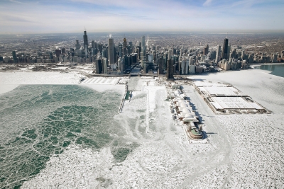
The polar vortex is capable of delivering subzero temperatures for several days together In the recent past, the 2014 polar vortex is remembered as it gave rise to record low temperatures which lasted until March.
Some scientists suggest that warming in the Arctic and climate change could make the polar vortex unstable in the coming years, leading to potentially serious consequences.
Picture Credit : Google