The river flows through Bhutan in a south-west direction between two ranges of the Lower Himalayas in V-shaped gorges and enters into Assam in India into the south-central foot hills of the Himalayas.
The river valley has two major reserve forest areas, namely the Royal Manas National Park (43,854 hectares (108,370 acres), established in 1966) in Bhutan and the contiguous Manas Wildlife Sanctuary (391,000 hectares (970,000 acres) in 1955 increased to 95,000 hectares (230,000 acres) in December 1985) encompassing Project Tiger reserve, an elephant reserve and a biosphere reserve, which constitutes a UNESCO World Heritage Site declared in December 1985.
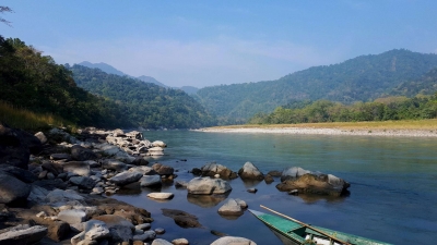
The Manas River drains 41,350 square kilometres (15,970 sq mi) of eastern Bhutan and northeast India. It has three major branches: the Drangme Chhu, Mangde Chhu, and Bumthang Chhu that cover most of eastern Bhutan, with the Tongsa and Bumthang valleys also forming part of its catchment. The area drained in Bhutan territory is 18,300 km2 and is bound by the geographical coordinates 26.217°N 90.633°E. A part of the main stem of the river rises in the southern Tibet before entering into India at Bumla pass at the northwestern corner of Arunachal Pradesh.
Out of the large catchment of the river valley, protected or reserved areas have been specifically demarcated, both in Bhutan and India, which are declared national parks or sanctuaries. The two reserved forest and wild life areas cover an area of 9,938.54 square kilometres (3,837.29 sq mi), which account for about 24% of the total catchment area of 41,350 square kilometres (15,970 sq mi) of the Manas river valley; brief details are provided.
Picture Credit : Google