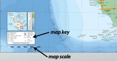
If you are using a map to get to your friend’s house, you can work out how far you have to travel. First, you have to learn something about distance. The word distance means the space between things. A map has to show distance much smaller than it actually is. So, at the top or bottom of most maps, you will see what looks like a ruler. This is called the map scale. The scale shows what the distance on a map equals in real distance.
The scale shown on the previous page is a straight line on which distances are marked. Each mark stands for a certain number of miles or kilometres. To find the real distance between two places, you first measure the distance between them on the map. To do this, line up the two places on the edge of a piece of paper. Make a mark for each place. Then, move the paper down to the scale. Line up one mark with the 0 on the scale. Then read the number that lines up with the other mark.
To measure distance on a winding road on a map, place a string along the route you want to take. Let the string curve along the curves of the road. Then straighten the string and measure its length on the map scale. The number you get will be the total distance.
Picture Credit : Google


