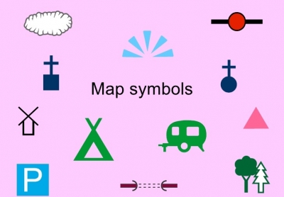
When you walk to the park, you might see trees, grass, flowers, and buildings. You won’t see these things on a map, but the map will still help you find out where the park is. How does it do this? With symbols.
Map symbols stand for real things on the surface of the earth. The map legend shows what the symbols mean. The colours help, too, Motorways are usually shown as red or black lines. The wider the line, the bigger the motorway. Crossed black lines stand for railway tracks, and a small black dot stands for a city. A star or dot inside a circle means a capital city. To find an airport, look for a tiny aeroplane on the map
Water is shown in blue, so squiggly blue lines show rivers. Sometimes colour is used to show the height of the land. Low land may be green. High mountains may be dark brown.
The next time you see a map, take a close look at it. You’ll be surprised to find how much a small map can show.
Picture Credit : Google


