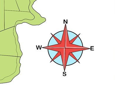
Map laps can give you lots of information about exciting places, if you know how to read them. To read a map, you have to understand “map language”. Map language is made up of names, numbers, colours, shapes, lines, and tiny pictures called symbols. These names, numbers, and symbols stand for the things you might look for on a map, such as cities, rivers, or roads. Most maps also have a map legend. A map legend explains what the symbols and colours on a map mean. An important word in map language is direction. The most important directions to know are north, south, east, and west. North is the direction that leads to the North Pole. South is the opposite. It faces the South Pole. East is where the sun rises and west is where the sun sets.
When maps are printed, the direction north is usually towards the top of the paper, and south is at the bottom. On these maps, east is at the right edge of the map, and west is at the left edge. But sometimes, north is not at the top of the map. How do you know if it is or isn’t? Often a pointer on the map tells you which direction is north.
Picture Credit : Google


