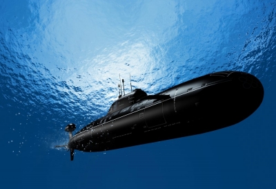
Submarines often travel in the ocean depths for weeks on end. They do not need to surface to check their position by the Sun, Moon or stars, because the latest navigation systems allow them to know where they are to within less than 320ft (100m) of their actual position while still submerged.
These systems are known as inertial navigation systems and are computer-controlled. There are usually at least two on a submarine, operating independently. They are a modern version of ‘dead reckoning’ — calculating where you are by measuring exactly how far you have come from your starting point, and in what direction.
The inertial navigation system is held absolutely horizontal and pointing in a fixed direction by gyroscopes, whatever the attitude of the submarine.
At the start of the voyage, the instruments are fed with the submarine’s exact position. An accelerometer then measures movement in every direction, and the computer works out the overall distance and direction travelled, thus establishing the present position.
Sonar is used to determine the water depth below the vessel to prevent it running aground. Inertial systems are on the whole accurate, but the small errors they do make gradually accumulate. They have to be realigned regularly. This is done by picking up radio signals from satellites in space, which form part of the American NAV-STAR Global Positioning System (GPS). The submarine has to partly surface.
The satellites transmit a radio message which contains precise details about their orbit, and a time signal controlled by an atomic clock. In effect, the signal says ‘It is now time X’. The submarine uses its own clock to calculate how long it takes the signal to arrive. As radio waves travel at 186,000 miles (300,000km) per second, the navigators can calculate the sub-marine’s distance from the satellite by the time the signal takes. By calculating the distance from three GPS satellites, the ship’s position can be pinpointed on a chart.
During the 1990s, the last 04 18 satellites in the GPS system will be placed in orbit at a height of 12,500 miles ,20.000km), orbiting the Earth at 12-hourly intervals. They will ensure that at any time at least four satellites will be available for navigators to calculate their position to within 550yds (500m;
The GPS system has virtually replaced older forms of submarine navigation such as the OMEGA system, but submarines still carry it as a back-up. This system detects radio signals broadcast from eight stations dotted around the Earth’s surface — in Japan. Hawaii, Australia, Argentina, North Dakota. Norway. Liberia and Reunion Island. These stations broadcast at very long wavelengths, so their signals carry all around the world. The signals are synchronised, and by measuring the time differences in their reception, a sub-marine’s position can be estimated to within about miles (3.2km)
Inertial navigation also mounted in long-range intercontinental launched from submarines .
Picture Credit : Google